

Jakarta, ThedailyID — Indonesia was hit by three earthquakes in different regions on Saturday, August 15, 2026.
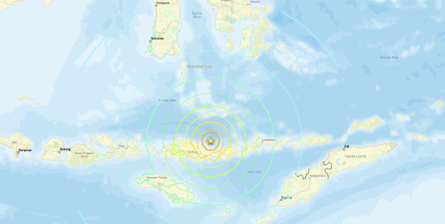
The first and strongest earthquake struck northeast of Mbay, Nagekeo Regency, East Nusa Tenggara, at 4:58 a.m. local time. The quake had a magnitude of 7.7.


Following the earthquake, Indonesia’s Meteorology, Climatology and Geophysical Agency (BMKG) issued an early tsunami warning for several areas, particularly East Nusa Tenggara and Selayar Islands in South Sulawesi.
BMKG later ended the tsunami warning. However, the agency reported rising waves along several coastal areas.
The second earthquake struck Simalungun Regency in North Sumatra at 5:54 p.m. It had a magnitude of 6.4 and occurred at a depth of 163 kilometers.
According to BMKG, the epicenter was located on land at coordinates 2.97°N and 98.95°E. The earthquake did not pose a tsunami threat.
Meanwhile, the third earthquake struck Parigi Moutong, Central Sulawesi, at 11:25 p.m. The quake had a magnitude above 6.2.
The epicenter was located 82 kilometers southwest of Parigi Moutong, at coordinates 0.25°N and 120.22°E. The earthquake occurred at a depth of 44 kilometers.
BMKG said the third earthquake also had no tsunami potential.
The three earthquakes occurred in separate regions over the course of the same day, with the Nagekeo earthquake triggering the only tsunami warning among the three events.