
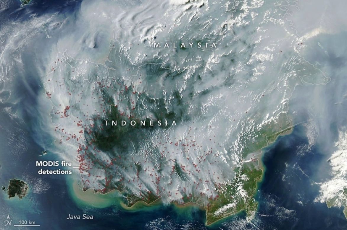
Jakarta, ThedailyID — A NASA satellite image shows much of Kalimantan covered by thick smoke from widespread land and forest fires on September 1, 2026.
The smoke did not remain within Indonesia. The same image shows haze stretching into Malaysia’s Sarawak and Sabah, which share the island of Borneo with Kalimantan.


The red dots in the image represent thermal anomalies detected by MODIS, an imaging instrument aboard NASA’s Aqua satellite. They indicate areas with unusually high temperatures rather than visible flames from space.
NASA said many of the fires involved peatlands. Peat fires can burn slowly beneath the surface, making them difficult to extinguish.
These fires can also produce more pollutants than typical tropical forest fires. According to NASA, peat fires generate three times more fine particles, five times more sulfur dioxide and twice as much methane.
The situation comes amid prolonged dry conditions across Indonesia. Data from Indonesia’s meteorological agency showed that around 90 percent of the country received little to no rainfall in early August.
Indonesia’s SiPongi monitoring system recorded 946 hotspots on August 31, 2026. West Kalimantan recorded the highest number with 455 hotspots, followed by Central Kalimantan with 308 hotspots.
The satellite image highlights how fires in Kalimantan can create a regional haze problem. Smoke can travel across borders and affect neighboring areas in Malaysia.